Geology
In 1949 the Dutch geologist Rein van Bemmelen reported that Lake Toba was surrounded by a layer of ignimbrite rocks, and that it was a large volcanic caldera. Later researchers found rhyolite ash similar to that in the ignimbrite around Toba (now called Young Toba Tuff to distinguish it from layers deposited in previous explosions) in Malaysia and India, 3,000 km away. Oceanographers discovered Toba ash, with its characteristic chemical "fingerprint", on the floor of the eastern Indian Ocean and the Bay of Bengal.
The eruption
The Toba eruption (the Toba event) occurred at what is now Lake Toba about 67,500 to 75,500 years ago.[2] It had an estimated Volcanic Explosivity Index of 8 (described as "mega-colossal"), making it possibly the largest explosive volcanic eruption within the last twenty-five million years. Bill Rose and Craig Chesner of Michigan Technological University deduced that the total amount of erupted material was about 2800 cubic km (670 cubic miles) — around 2,000 km³ of ignimbrite that flowed over the ground and around 800 km³ that fell as ash, with the wind blowing most of it to the west. By contrast, the 1980 eruption of Mount St. Helens ejected around 1.2 cubic km of material, whilst the largest volcanic eruption in historic times, at Mount Tambora in 1815, emitted the equivalent of around 100 cubic kilometres of dense rock and created the "Year Without a Summer" as far away as North America.
The Toba eruption was the latest of a series of at least three caldera-forming eruptions which have occurred at the volcano. Earlier calderas were formed around 700,000 and 840,000 years ago.[3]
To give an idea of its magnitude, consider that although the eruption took place in Indonesia, it deposited an ash layer approximately 15 cm (6 in) thick over the entire Indian subcontinent; at one site in central India, the Toba ash layer today is up to 6 m (20 feet) thick[4] and parts of Malaysia were covered with 9 m of ashfall.[5] In addition it has been calculated that 1010 metric tons of sulphuric acid was ejected into the atmosphere by the event, causing acid rain fallout.[6]

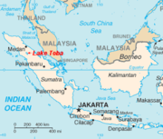
The subsequent collapse formed a caldera that, after filling with water, created Lake Toba. The island in the center of the lake is formed by a resurgent dome.
Though the year can never be precisely determined, the season can: only the summer monsoon could have deposited Toba ashfall in the South China Sea, implying that the eruption took place sometime during the northern summer.[7] The eruption lasted perhaps two weeks, but the ensuing "volcanic winter" resulted in a decrease in average global temperatures by 3 to 3.5 degrees Celsius for several years. Greenland ice cores record a pulse of starkly reduced levels of organic carbon sequestration. Very few plants or animals in southeast Asia would have survived, and it is possible that the eruption caused a planet-wide die-off. There is some evidence, based on mitochondrial DNA, that the human race may have passed through a genetic bottleneck within this timeframe, reducing genetic diversity below what would be expected from the age of the species. According to the Toba catastrophe theory proposed by Stanley H. Ambrose of the University of Illinois at Urbana-Champaign in 1998, human populations may have been reduced to only a few tens of thousands of individuals by the Toba eruption.[8]
More recent activity

Smaller eruptions have occurred at Toba since. The small cone of Pusukbukit has formed on the southwestern margin of the caldera and lava domes. The most recent eruption may have been at Tandukbenua on the northwestern caldera edge, since the present lack of vegetation could be due to an eruption within the last few hundred years.[9]
Some parts of the caldera have experienced uplift due to partial refilling of the magma chamber, for example pushing Samosir Island and the Uluan Peninsula above the surface of the lake. The lake sediments on Samosir Island show that it has been uplifted by at least 450 metres[10] since the cataclysmic eruption. Such uplifts are common in very large calderas, apparently due to the upward pressure of unerupted magma. Toba is probably the largest resurgent caldera on Earth. Large earthquakes have occurred in the vicinity of the volcano more recently, notably in 1987 along the southern shore of the lake at a depth of 11 km.[11] Other earthquakes have occurred in the area in 1892, 1916, and 1920-1922.[12]
Lake Toba lies near a fault line which runs along the centre of Sumatra called the Sumatra Fracture Zone.[13] The volcanoes of Sumatra and Java are part of the Sunda Arc, a result of the northeasterly movement of the Indo-Australian Plate which is sliding under the eastward-moving Eurasian Plate. The subduction zone in this area is very active: the seabed near the west coast of Sumatra has had several major earthquakes since 1995, including the 9.3 2004 Indian Ocean Earthquake and the 8.7 2005 Sumatra earthquake, the epicenters of which were around 300 km from Toba.
On September 12th, 2007, a magnitude 8.4 Earthquake shook the ground by Sumatra and was felt in the Indonesian capital, Jakarta. The epicenter for this earthquake was not as close as the previous two earthquakes, but it was in the same vicinity.

No comments:
Post a Comment